The source footage
Reuters published a video said to show Houthi forces capturing the Khaled bin Walid camp in Yemen, noting that it could not independently verify where or when the footage was filmed.
The original footage is available via Haystack News. As redistribution rights have not been confirmed, the full video is linked rather than reproduced here:
Watch the full source video on Haystack News ↗
From Mocha to Mafraq al Mukha
For difficult geolocations, I usually start by reconstructing the spatial structure of the scene: roads, terrain, buildings, sightlines, and the position of objects relative to one another. I then look for a place that can explain the whole structure, rather than a single similar-looking object.
The first useful clue came from the Reuters description of the footage, which refers to a reporter in the video identifying the location as “Mocha intersection.”
Source: Reuters description via MarketScreener ↗
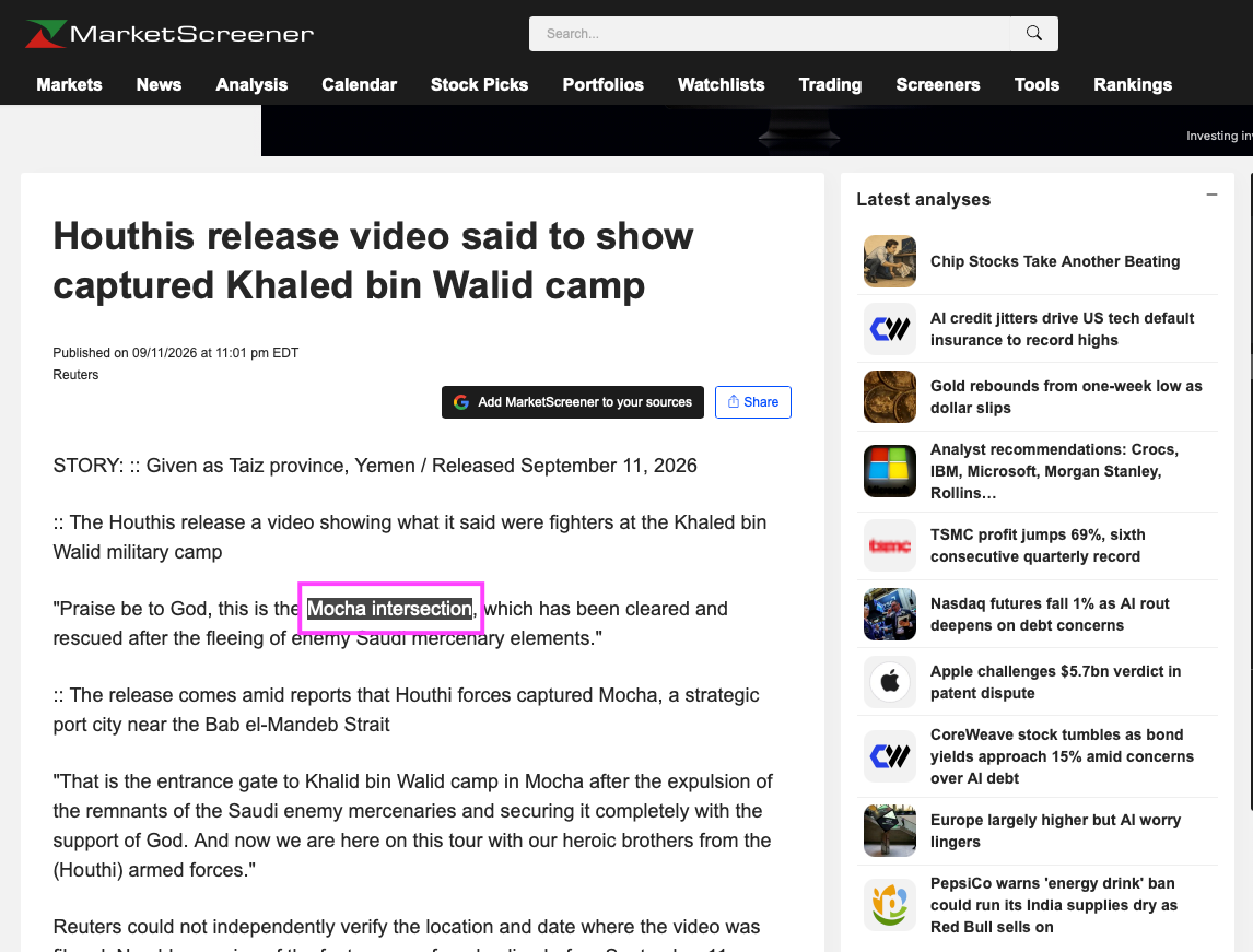
Searching that phrase directly was not very helpful. But “intersection” or “junction” can correspond to the Arabic مفرق, mafraq, while Mocha is المخا, al-Mukha.
That led to the local name مفرق المخا, Mafraq al Mukha, giving me a much more precise area to search.
A cut slope beside the road
Once I had a search area around Mafraq al Mukha, I went back to the video and examined the first scene more closely.
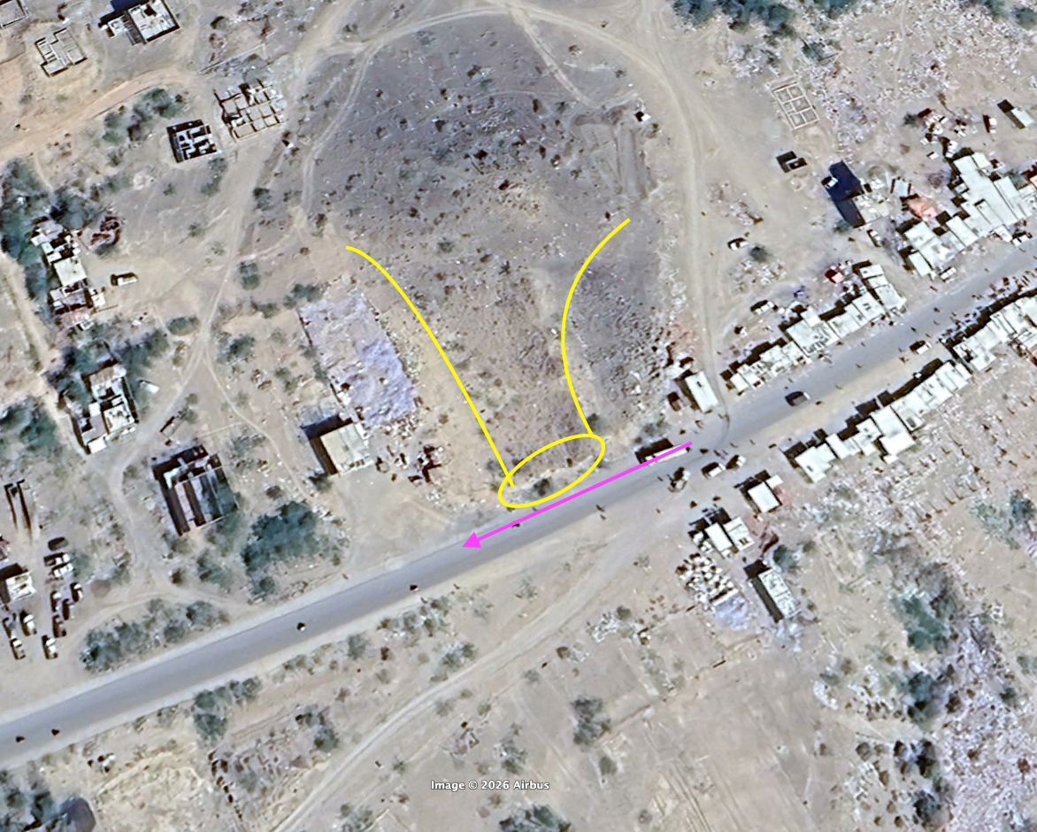
The strongest visual feature was a steep exposed cut slope immediately beside the road. Its face runs right up to the road, creating a very distinctive terrain-road geometry.
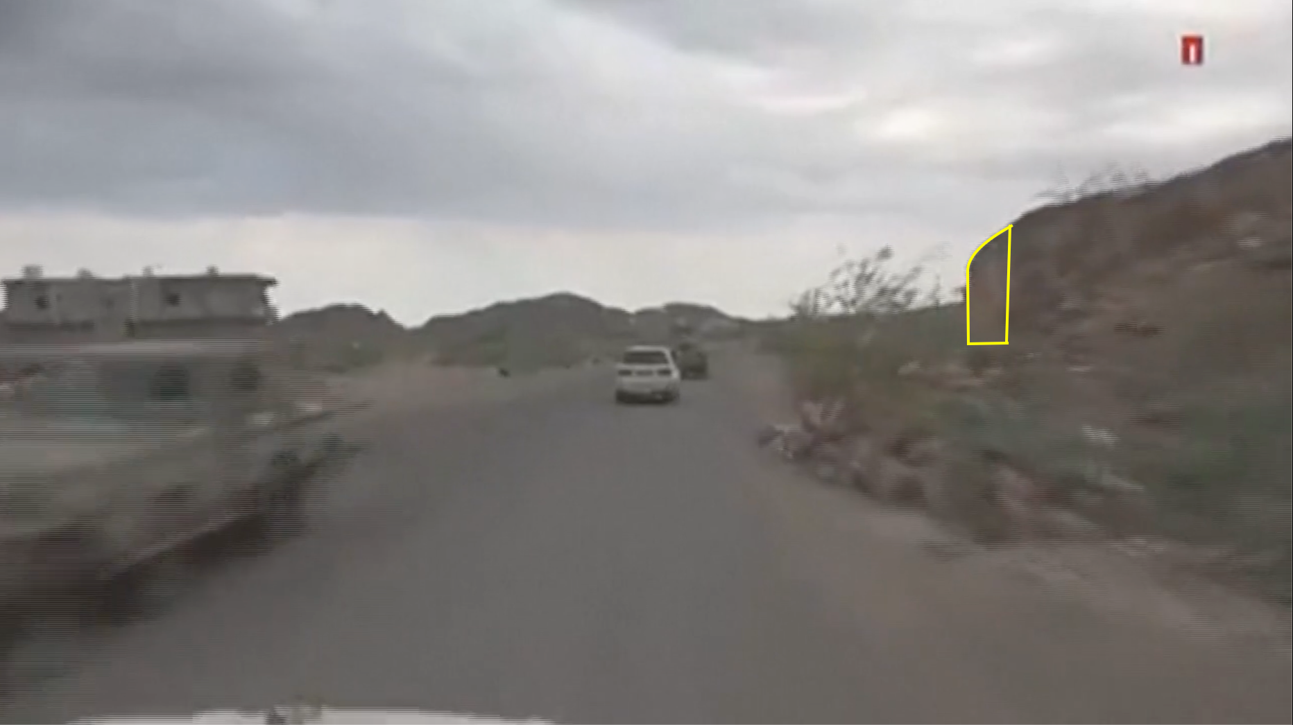
I then searched the satellite imagery for a place where the relief meets the road in the same way.
That was the first point where the scene started to lock into place.
Reading the 2023 imagery
The match was not perfect. Some buildings visible in the video were absent from the latest satellite imagery available to me, dated 2023.
I considered the possibility that these differences reflected changes to the area after the 2023 satellite image was taken, rather than a mismatch in location. On the satellite image, those video-only structures are shown as dashed outlines.
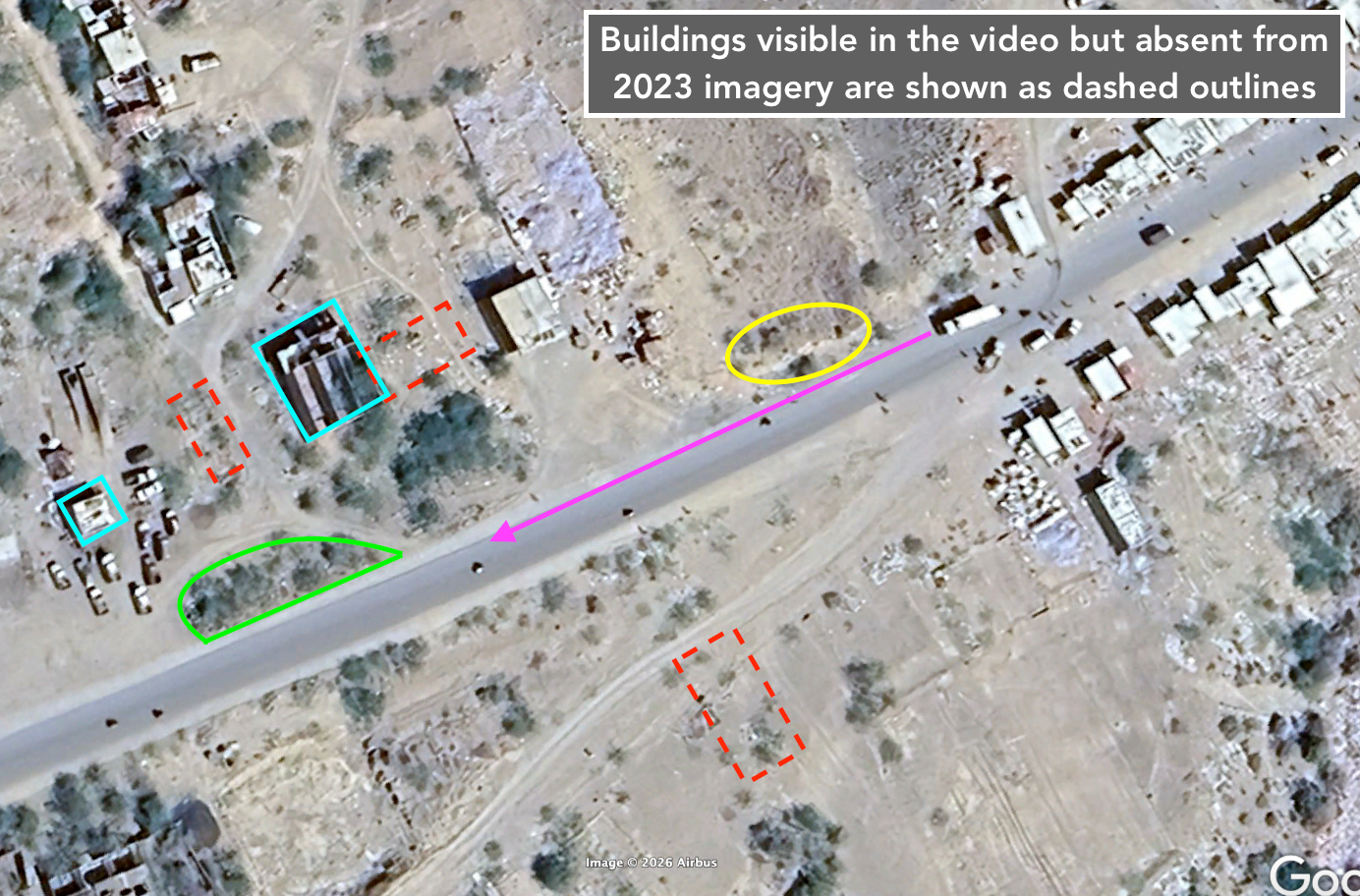
So I focused on more stable features, the cut slope, road geometry, surviving buildings, and their relative positions. Together, they still made this a strong candidate.
Testing the tower hypothesis
Around five seconds into the first scene, a tower-like structure becomes visible on a hill to the right of the road.
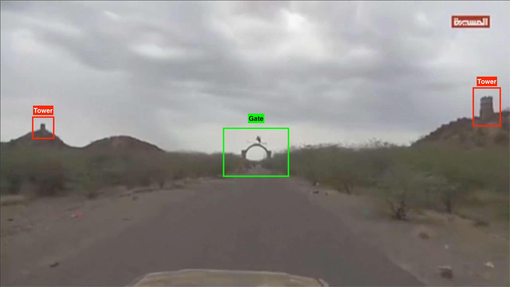
After the cut at about 12 seconds, the camera is much closer to the camp gates, and a very similar tower-like structure is still visible on the right.
My first hypothesis was simple: both scenes might be showing the same tower.
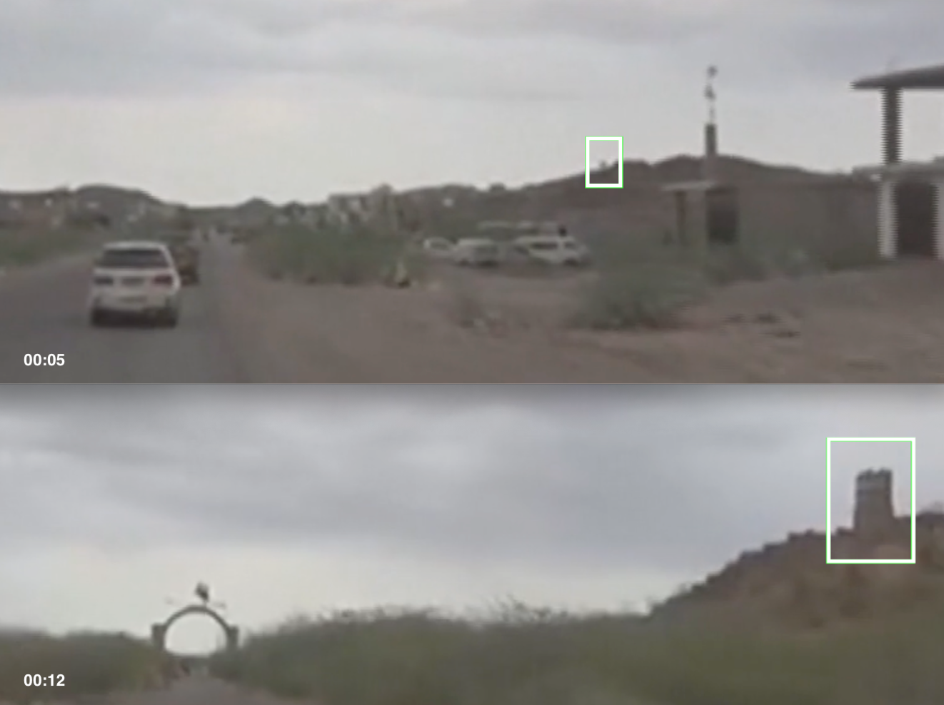
The pattern of low dark clouds changes between the two scenes, although this is only a secondary clue and does not establish the camera's orientation. The suspected same tower remains on the right in both views. If it is indeed the same structure, a bend in the road could explain the different perspectives. My working hypothesis was a significant right-hand bend before reaching the camp gates.
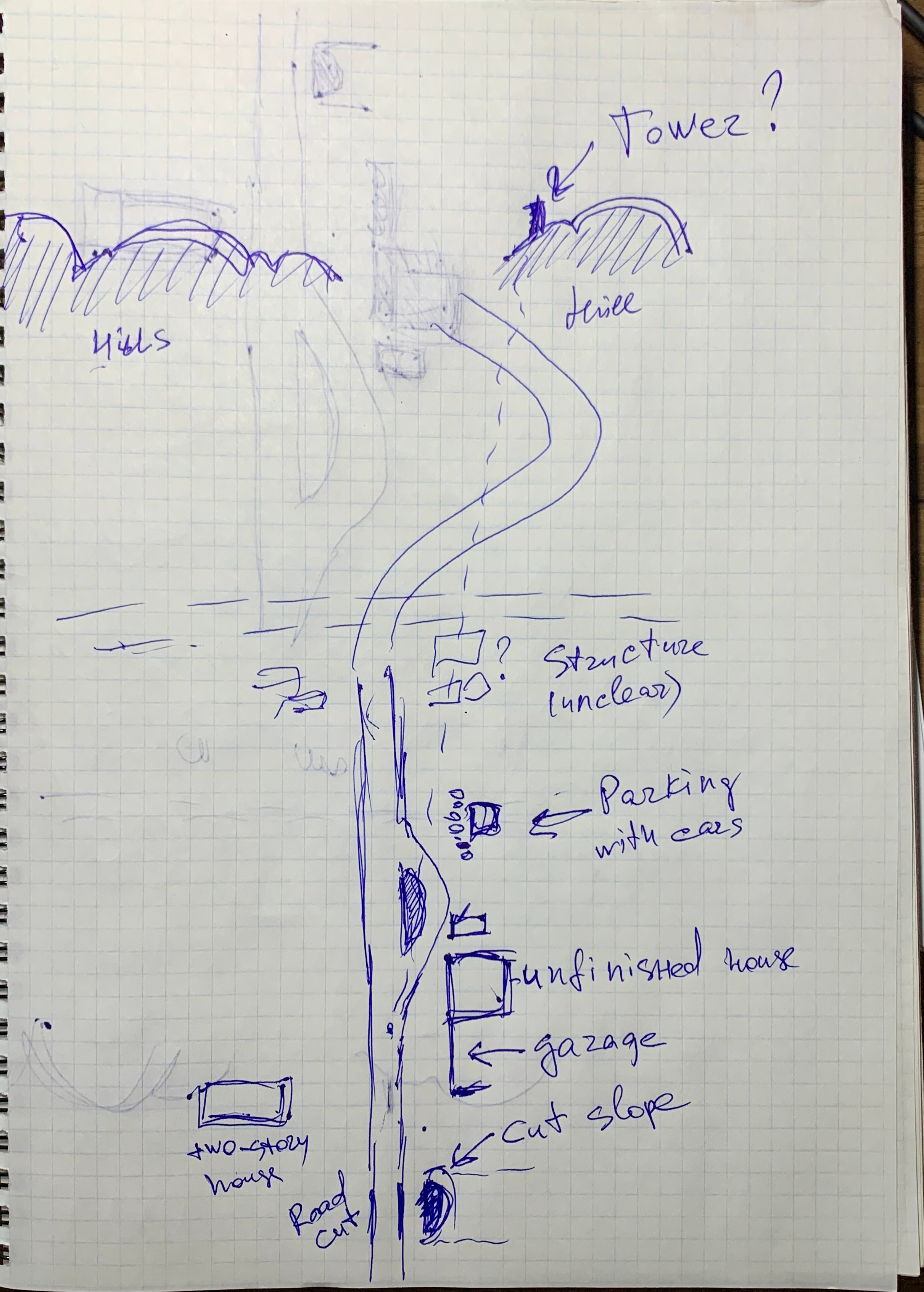
This is a rough working sketch I made for myself while analyzing the footage, not a polished diagram.
Following the sightline
The strongest test came from the first scene. I traced a sightline from the road beside the cut slope, through the parking area and the one-story building, toward the tower on the horizon.
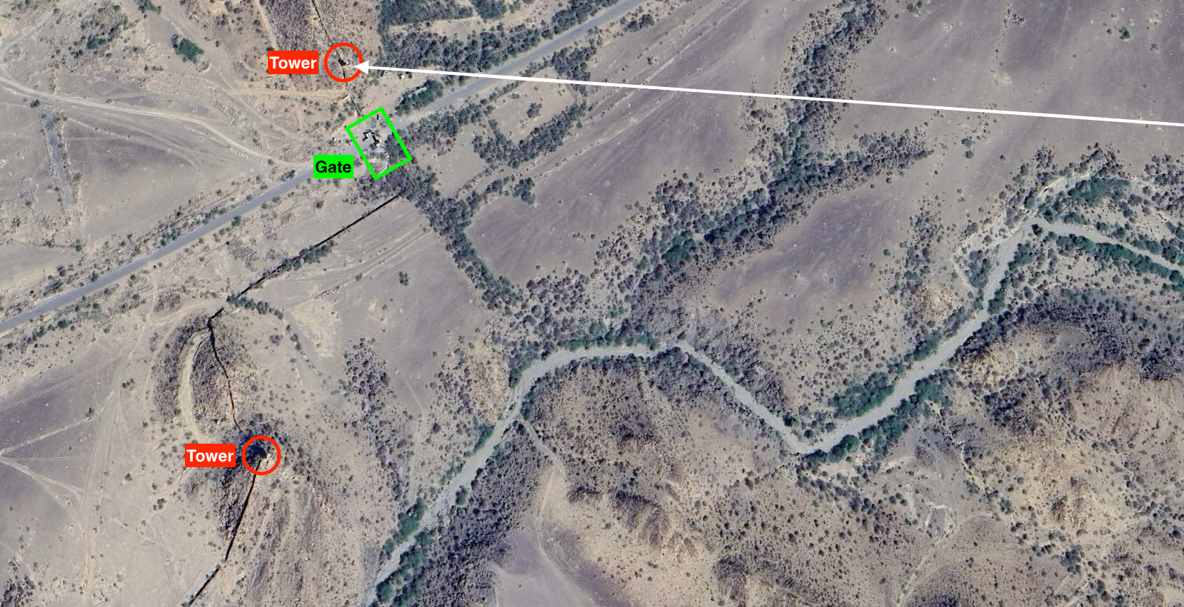
When I transferred that same line to the map, it pointed directly toward the tower-like structure beside the camp gates.
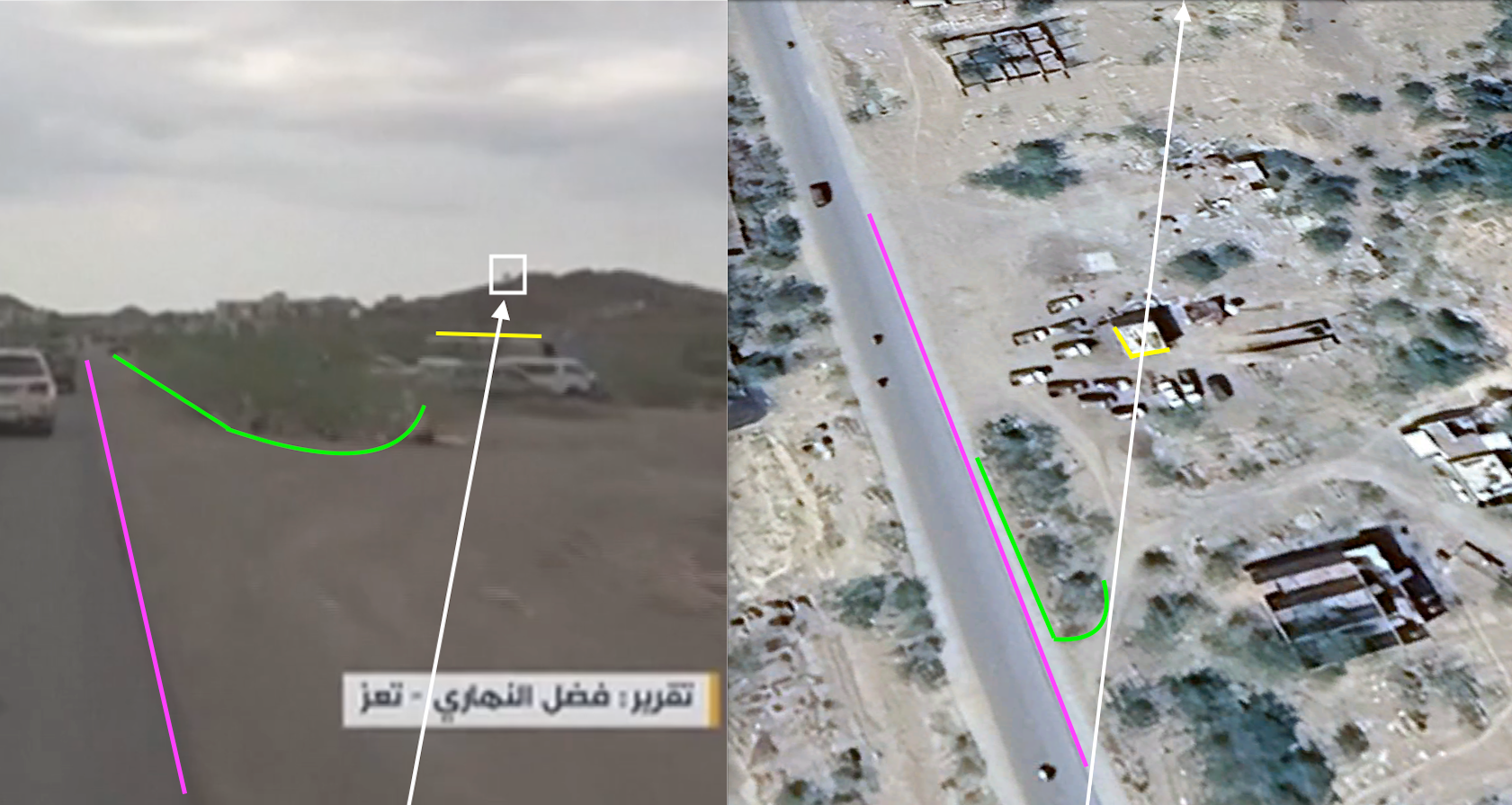
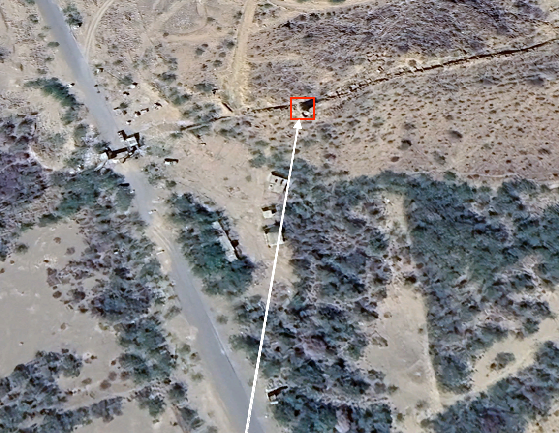
The map then resolved both working hypotheses at once.
The road does make the expected right-hand bend before the camp. And the tower seen in the first scene aligns with the same tower beside the gates in the second.
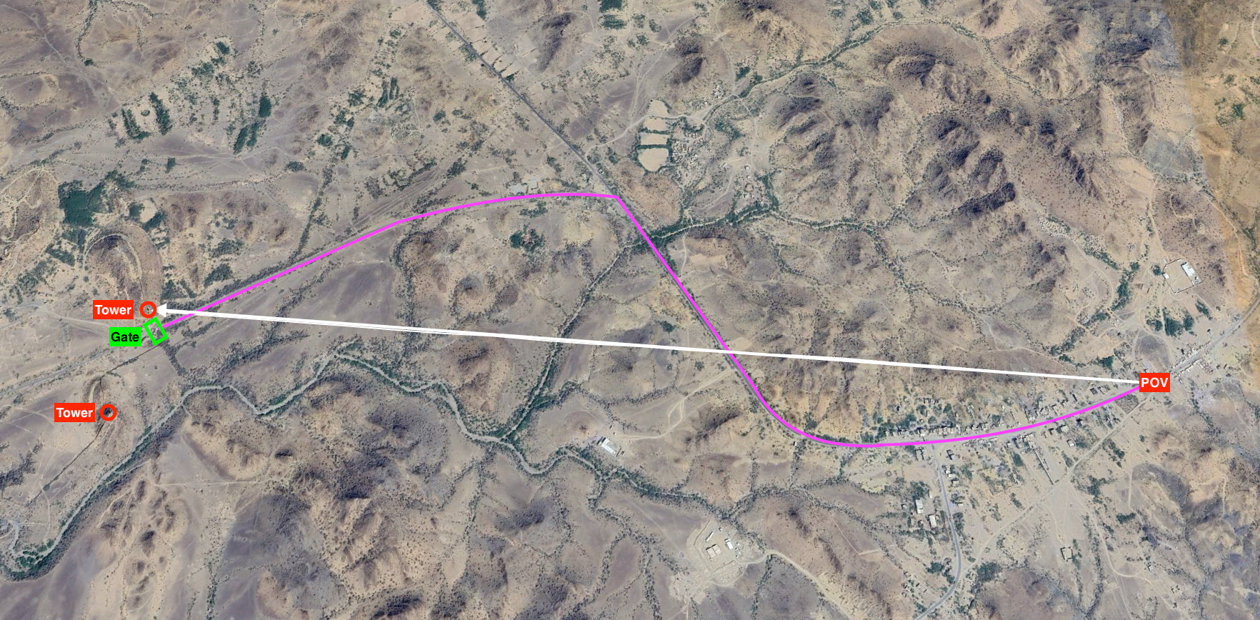
What had started as two separate assumptions, the same tower and a change in road direction, now converged in one real spatial layout.
What the match establishes
The result: the footage can be independently geolocated to the road leading to the Khaled bin Walid camp in Yemen.
The match is based not on a single object, but on the combined geometry of the terrain, road, buildings, sightlines, road bend, and the two video scenes.
This investigation verifies the location. It does not independently establish the filming date or who controlled the camp when the footage was recorded.
Reported coordinates
Coordinates supplied by the investigator. The decimal places reproduce the case record and do not state survey accuracy.
- Camera point of view
- 13.365638132432675, 43.6251673929553 ↗
Sources
- Reuters Connect: Iran-aligned Houthis said they captured Mocha. The source record states that Reuters could not independently verify the filming location or date.
- MarketScreener: Reuters transcript and description.
- Haystack News: full Reuters video.
- Google Earth satellite imagery. The latest image used in this investigation is dated 2023.
Credits and citation
George Sudo (GeoSudoku)
Investigation, geolocation, working sketch, and figure annotations by George Sudo (GeoSudoku). SSX360 editorial preparation by Ryan James York.
George Sudo (GeoSudoku). “Reconstructing the Road to Khaled bin Walid Camp.” SSX360: Security Services X-Ray, Field Report 002, October 26, 2026.
ssx360.com/publication/002/Final web edition · Free to read · Published October 26, 2026
Questions or corrections: mission@ssx360.com. See our editorial and corrections policy.